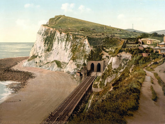
Two photographs with similar views of an iconic natural landmark:
one taken during a Coronavirus Lock Down bike ride, and the other, a
Victorian photo-mechanical print dated circa 1890-1900.
1) Shakespeare Cliff on the 15th of April, 2020
The headland jutting out into the English Channel,
previously known as Hay Cliff, Hay Hill, and with various alternate
spellings ("Shakespeare Cliffe", "Shakspere Cliff", etc.), marks the
point where Great Britain most closely approaches continental Europe, specifically France.
The cliff was renamed as a result of William Shakespeare's references to it in his tragedy, King Lear (based on the legend of Leir of Britain, a mythological pre-Roman Celtic king).
King Lear
Act IV, Scene I ("The Heath")
EARL OF GLOUCESTER (sometimes GLOSTER)
Dost thou know Dover?
EDGAR (SON OF GLOUCESTER)
Ay, master.
GLOUCESTER
There is a cliff, whose high and bending head
Looks fearfully in the confined deep:
Bring me but to the very brim of it,
And I'll repair the misery thou dost bear
With something rich about me: from that place
I shall no leading need.
EDGAR
Give me thy arm:
Poor Tom shall lead thee.
In Act IV, Scene VI ("Fields near Dover"), Edgar has deceived the
blinded Gloucester into believing he is on the edge of Shakespeare
Cliff:
EDGAR
Come on, sir; here's the place: stand still. How fearful
And dizzy 'tis, to cast one's eyes so low!
The crows and choughs that wing the midway air
Show scarce so gross as beetles: half way down
Hangs one that gathers samphire, dreadful trade!
Methinks he seems no bigger than his head:
The fishermen, that walk upon the beach,
Appear like mice; and yond tall anchoring bark,
Diminish'd to her cock; her cock, a buoy
Almost too small for sight: the murmuring surge,
That on the unnumber'd idle pebbles chafes,
Cannot be heard so high. I'll look no more;
Lest my brain turn, and the deficient sight
Topple down headlong.
GLOUCESTER
Set me where you stand.
EDGAR
Give me your hand: you are now within a foot
Of the extreme verge: for all beneath the moon
Would I not leap upright.
GLOUCESTER
Let go my hand...
2) Victorian view of Shakespeare Cliff
Derived from a United States Library of Congress photo-mechanical print
dated circa 1890-1900.
Intriguing lattice tower or mast in the distance:
Marconi made the first ship to shore radio transmission from nearby South
Foreland Lighthouse (several miles behind the viewer, on the other side of Dover) in 1898,
French government didn't allow wireless
telegraphy across English Channel until 1899. What and when could this tower be? A military signalling (eg semaphore) station?
A cycling route map and biometrics during which I took the first photo can be seen on this Polar Flow web page.
Abridged versions of this post are also on Facebook and Twitter.


No comments:
Post a Comment